


Office software
Trimble Terra Office
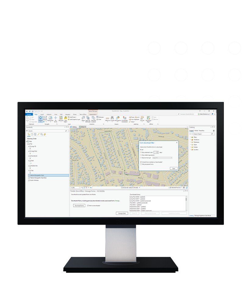
Connect TerraFlex to a GIS system-of-record.
Trimble® Terra™ Office software helps mapping and GIS professionals manage high-accuracy Trimble TerraFlex™ data collection projects and integrate collected data into a variety of GIS systems-of-record, including Esri® ArcGIS®.
Benefits
Provides direct integration
Direct integration with a GIS system-of-record eliminates the need for lossy, manual import/export steps.


Ensures data integrity
Ensures that for the entire workflow, data collected in the field is complete with the three key aspects of field data: geometries, attributes and metadata.

Affordable
Enable any office GIS worker
Flexible
Manage licenses on your own
Up-to-date
Automatically get new features
Features and capabilities

Simplify your workflows
Terra Office understands ArcGIS and provides native support for ArcGIS Pro and feature services hosted on ArcGIS Online and ArcGIS Enterprise.

Data you can trust
Maintain full GNSS metadata from the field through into the office to ensure Trimble-quality data is stored in your GIS.

Fewest clicks to field worker productivity
Simple workflows for extending your GIS to the field for efficient data collection and maintenance workflows using TerraFlex.

Work how you want
Includes desktop tools and workflows for users with limited cloud access or who have integration requirements for on-premise systems-of-record.
Product summary
Trimble Terra Office
Connecting TerraFlex to your GIS system-of-record
Product
Features
Works with ArcGIS
Add-ins for ArcGIS Pro & ArcMap
Easy licensing
Annual subscription
Simplified geodetics
Automatic config. prevents mistakes
Data integrity
Enforces all rules from GIS schema
Offline corrections
Uses offline GNSS corrections
Export to CAD
Standalone exporter for CAD & GIS
Trimble Terra Office functionality is available in three different editions.
Terra Office add-in for ArcMap
Add-in for Esri ArcGIS Desktop 10.2 or higher
Connect TerraFlex to on-premise ArcGIS geodatabases for a full data collection workflow. Supports real-time and offline GNSS correction workflows as well as local post-processing and TerraFlex Direct workflows. Requires a Terra Office Standard subscription.
Terra Office add-in for ArcGIS Pro
Add-in for Esri ArcGIS Pro 3.0 or higher
Connect TerraFlex to ArcGIS geodatabases and feature services for a full data collection workflow. Supports real-time and offline GNSS correction workflows using the cloud. Requires a Terra Office Standard subscription.
Terra Office Exporter
Standalone utility
Export collected TerraFlex data to CAD and other GIS formats using this simple desktop application. Requires a Terra Office Basic subscription.
Office software
Trimble Terra Office
Get in touch for recommendations for the Geospatial hardware, software, and accessories needed to get your job done.
Where to buyWorks with...

Resources and knowledge


Inspiring perspectives

Watch what Trimble can do

Join us live or later
Next steps
Our global network of Distribution Partners provides precision geospatial solutions, insight and support at a local level.